
Ever wondered how to uncover hidden patches of greenery in your city without wrestling with API keys or complex satellite data pipelines? That’s exactly what the greenspace-detection-platform is all about. Born from a clever mix of Next.js, Python, STAC, and Sentinel-2 satellite data (via the Microsoft Planetary Computer), this tool delivers beautifully aligned, key-free vegetation analysis, boosting detection by a whopping 46% compared to standard methods GitHub.
https://github.com/main-salman/greenspace-detection-platform
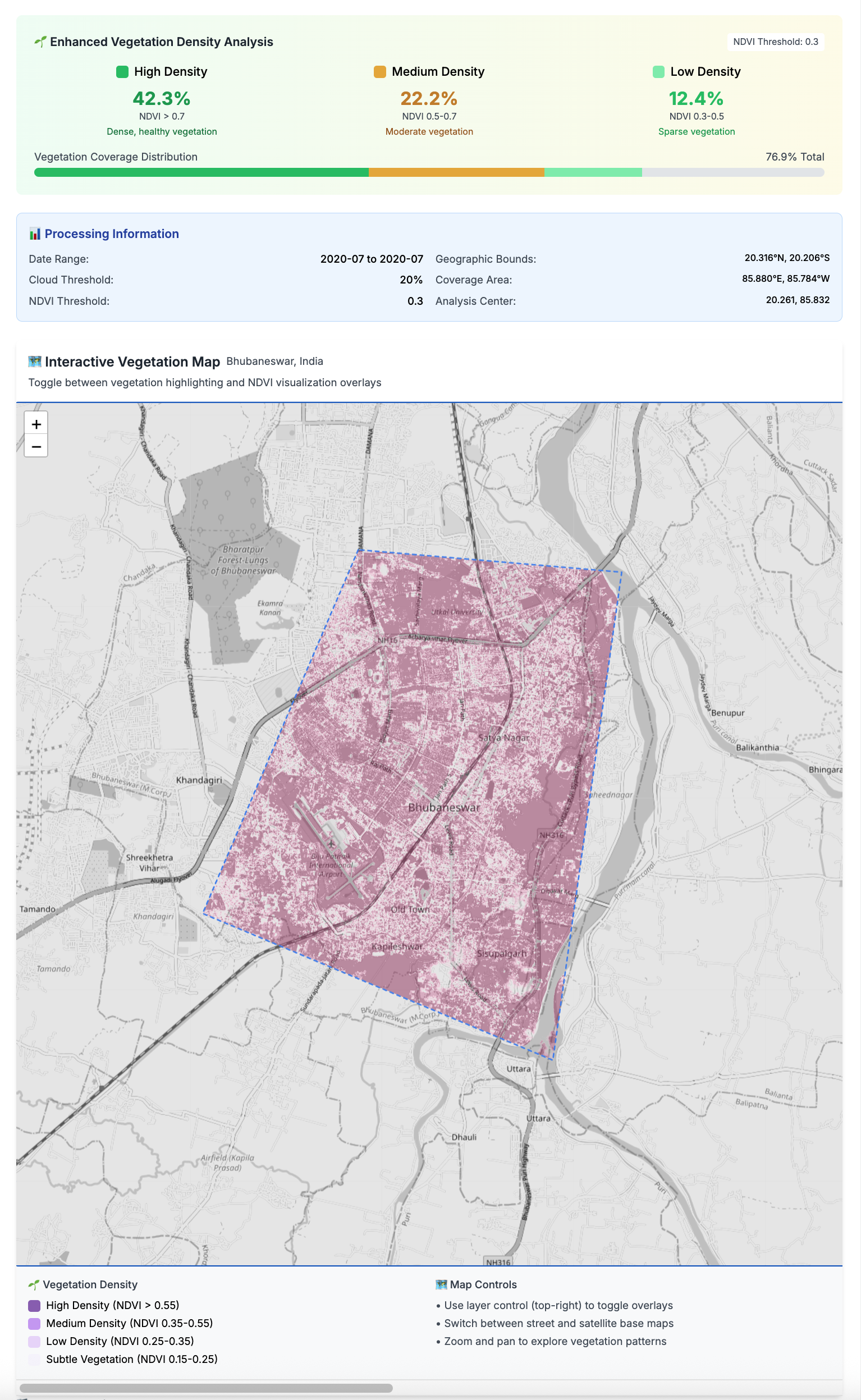
What’s particularly fun is how it brings everything to life: you pick your city (Toronto’s even on the list!), tweak sensitivity and date range, and watch the platform render a purple-gradient map showing dense forests, parkland, grass, and subtle green hints—all geo-aligned to sub-pixel accuracy and ready to toggle between grayscale, OSM, or satellite views GitHub. Under the hood, sub-pixel precision and smart CRS transformations ensure images align perfectly, while Leaflet, OpenCV, and Rasterio stitch it all together in the frontend and backend.
Whether you’re a hackathon pro or just curious about urban ecology, this is a seriously cool project to play with—or build on. Installation is a breeze with npm install, npm run setup, and then launch with npm run dev GitHub. You’ll be inspecting greenness in your favorite city in just a few clicks—perfect for anyone with an eye for code and a soft spot for nature.

Leave a comment